

Calculation Settings
Every Meteonorm calculation is based on a set of options. Here we describe the options that are not self-explanatory.
Altitude
For the selected latitude and longitude, the altitude is automatically derived from the Copernicus GLO-30 Digital Elevation Model (DEM) with a spatial resolution of approximately 30 metres (at the equator). If you want to compute a TMY or AMY for, say, the top of the Eiffel Tower, you can overwrite the altitude manually.
Albedo
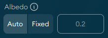
The albedo is the fraction of the short-wave solar radiation that is reflected by the ground. It is a dimensionless quantity between 0 and 1. The albedo of grass surfaces is typically around 0.2. If you choose "Auto", a default albedo of 0.2 is used, but it is dynamically being adapted to snow cover (if any). If you choose "Fixed", then the albedo is not adapted to snow cover.
Azimuth and Tilt
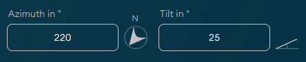
The azimuth and tilt settings allow you to set the orientation and tilt/inclination of a tilted plane, e.g., a solar panel, you want to model irradiance parameters for. The azimuth is a value between 0° and 360°, where 0° means "facing north", 90° means "facing east", 180° means "facing south", and 270° means "facing west".
Situation
The type of the surrounding terrain. For TMYs, this setting impacts the computation of the monthly temperature and wind speed climatologies, which form the baseline for the stochastic processes, which then result in hourly/minute time series for these parameters.
Some situation definitions are specific to the Swiss Alps. For locations outside the Alps, we suggest to use only Open Terrain, Depression, Sea/Lake, City, and Summit.
- Open Terrain (default): Open site, open terrain. Applies to most sites.
- Depression: Depression or very flat valley floor, in which cold air collects. In Switzerland, for example, particularly in the Jura and the Alps.
- Cold Air Lake: Extensively cold hollows (above 1000 m).
- Sea / Lake: Location on the coast or shore of a large lake (up to 1 km from the shore).
- City: Centre of a larger city (population of 100k or more)
- Slope South: South facing incline (more than approx. 10° inclination, facing between SE–S–SW). At least 200 m above valley floor.
- Slope West/East: West or east facing incline (more than approx. 10° inclination, facing between SW–W–NW or NE–E–SE). At least 200 m above valley floor.
- Valley: Valley floor in mountainous valley at higher altitudes. Valley floor inclined (flat valleys are often treated as depressions).
- Valley Foehn: Valley floor of Föhn valley (regions with warm descending air currents).
- Valley Central Alps: Floor of large central Alpine valley (e.g., Alpine regions of Valais, Switzerland).
- Valle Alpine Foothills: Valley floor in northern Alpine foothills.
- Valley Slope South: South facing incline (more than approx. 10° inclination, facing between SE–S–SW) up to 200
m above valley.
- Valley Slope West/East: West or east facing incline (more than approx. 10° inclination, facing between SW–W–NW or
NE–E–SE) up to 200 m above valley floor.
- Summit: Open summit above 500 m. Overlooking surroundings in all directions.
Horizon
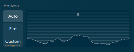
When set to "Auto" the horizon line is automatically derived from the Copernicus GLO-30 Digital Elevation Model (DEM) with a spatial resolution of approximately 30 metres (at the equator).
A "Flat" or almost flat (all elevation angles < 5°) horizon does not impact the irradiance parameters. But if the horizon is noticeably elevated, irradiance values can be significantly reduced, especially in the morning and evening hours.
Soon, it will be possible to define a "Custom" horizon line.
Turbidity

Turbidity is a measure of atmospheric haziness that describes the reduction of solar radiation due to aerosols and water vapor. Meteonorm uses the Linke turbidity factor to quantify the turbidity. It is a critical input for modeling the clear sky irradiance. A higher Linke turbidity factor indicates a hazier atmosphere, resulting in lower Direct Normal Irradiance (DNI) due to increased scattering and absorption of sunlight.
By default ("Auto"), turbidity is determined from the MERRA-2 reanalysis dataset.
Soon, it will be possible to set the turbidity manually ("Custom").
Clear Sky Model
The clear sky irradiance is the theoretical maximum solar radiation that reaches the Earth's surface under a completely cloudless sky. In other words, the clear sky irradiance is the upper bound for irradiance parameters. Any cloud cover or atmospheric obstruction then "subtracts" from this baseline to determine the actual global/direct/diffuse irradiance that reaches the surface.
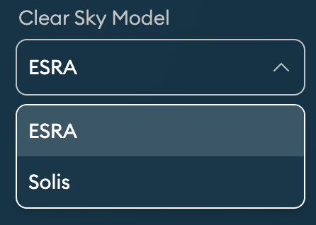
Two clear sky radiation models are available:
- ESRA (default): Clear sky radiation model based on the European Solar Radiation Atlas (ESRA). This model is suitable for most locations worldwide.
- Solis: This model is specially adapted to high turbidity locations such as the Sahel and Persian Gulf regions.
Meteorological Year
Choose between Typical and Actual Meteorological Years.
Typical Meteorological Year (TMY)
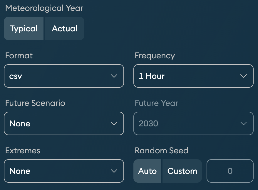
A TMY represents a statistically typical year with respect to some reference period – past or future. A TMY is generated stochastically. It is not representative of a specific historical year. Instead, it describes a year that is typical for the long-term climate of a given location and reference period.
- Format: Select your file format of choice. csv and json are the standard formats. In addition, for TMY, a set of proprietary formats are available.
- Frequency: Choose between hourly and 1-minute resolutions. Note that export (download) takes a bit longer for 1-minute data.
- Future Scenario: Select None if you want to generate a TMY based on the reference period 2001–2020. Or select one of the Shared Socioeconomic Pathways (SSP) defined by the Intergovernmental Panel on Climate Change (IPCC) to generate a TMY for the future.
- Future Year: Select the middle year of a 20-year period for which you want to generate a TMY. For example, the year 2040 represents the period 2031–2050.
- Extremes: Adjust the monthly climatologies used as the baseline for the stochastic
generation of the TMY. With this setting, you can simulate statistically significant
"edge cases", which allows you to stress-test your system against extreme temperature
and irradiance.
- None: Use median PoE50 values (Probability of Exceedance of 50%; PoE50)
- PoE10 Year: Use annual PoE10 (90th percentile) values
- PoE90 Year: Use annual PoE90 (10th percentile) values
- PoE10 Months: Use monthly PoE10 values
- PoE90 Months: Use monthly PoE90 values
- Worst Case Year: Use a combination of PoE10 in summer and PoE90 in winter (worst case heating/cooling load with cold/dark winter and hot/sunny summer)
- Random Seed: Select a random seed to be used for the stochastic generation of the TMY. Using the same random seed guarantees that the exact same TMY is generated each time you run the calculation. You can generate alternative TMYs by changing the seed value. However, while the overall statistical properties remain consistent across different seeds, the resulting time series can vary drastically.
Actual Meteorological Year (AMY)
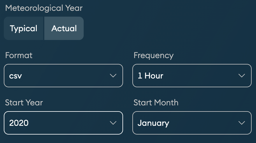
AMYs are based on historical satellite observations and global reanalysis datasets, post-processed for any location on Earth. Unlike a TMY, which represents a statistically "typical" year, an AMY reflects the actual weather conditions recorded during a specific year. That's why you have to select a Start Year and a Start Month.